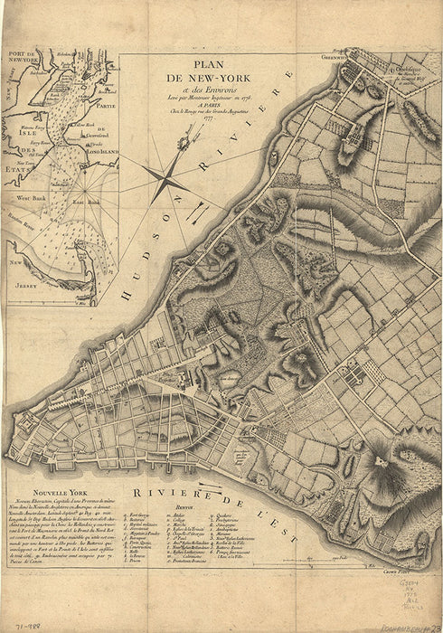

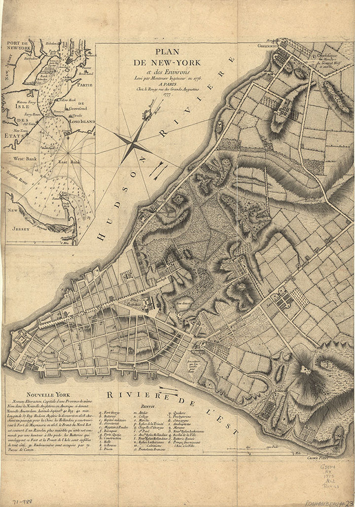
This modern reproduction print is made from a historically significant 18th Century map of New York City. The original map of the city and its surroundings was produced in Paris, France. Sized at 18"X26"
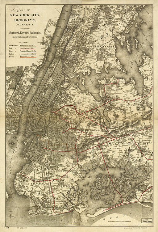
This listing is a beautiful modern reproduction print made from the original Map of New York City, Brooklyn, and vicinity showing surface & e...
View full details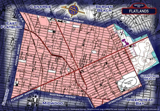
ۢAll purchased images are printed without the watermark. We have one of the largest archives of vintage Brooklyn & New York City photos availab...
View full details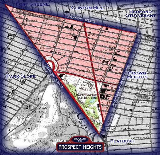
All purchased images are printed without the watermark. We have one of the largest archives of vintage Brooklyn & New York City photos availabl...
View full details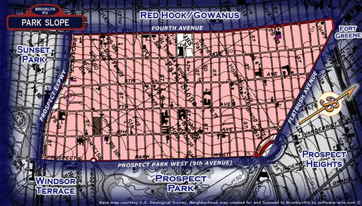
All purchased images are printed without the watermark. We have one of the largest archives of vintage Brooklyn & New York City photos availabl...
View full details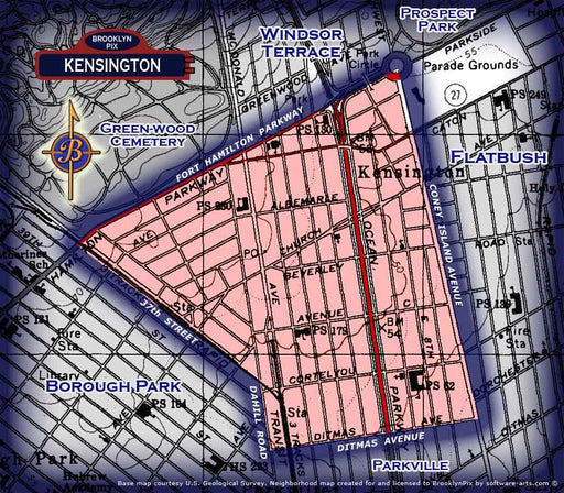
ۢAll purchased images are printed without the watermark. We have one of the largest archives of vintage Brooklyn & New York City photos availab...
View full details
This modern reproduction print is made from a historically significant 18th Century map of New York City. The original map of the city and its sur...
View full details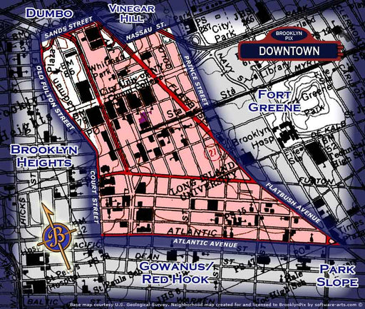
ۢAll purchased images are printed without the watermark. We have one of the largest archives of vintage Brooklyn & New York City photos availab...
View full details
ۢAll purchased images are printed without the watermark. We have one of the largest archives of old vintage Brooklyn & New York City photos ava...
View full details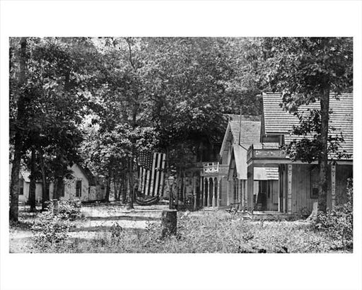
ۢAll purchased images are printed without the watermark. We have one of the largest archives of vintage Brooklyn & New York City photos availab...
View full details